About the Surveying and Mapping Authority
According to some estimates 80 percent of all information contains a reference to their location. Therefore it is extremely important for both individuals and communities to ensure a high-quality and globally interoperable infrastructure for the geographical positioning of data.
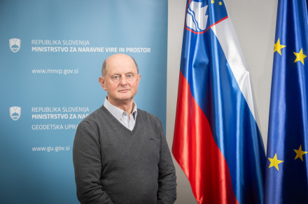
Leadership
-

Tomaž Petek
Director-General
Surveying and Mapping Authority of the Republic of Slovenia
Activities and role
The Surveying and Mapping Authority performs tasks related to the establishment, management and maintenance of databases concerning the basic geodetic system, the recording of real estate, the mass valuation of real estate, the state border, spatial units and house numbers, the consolidated cadastre of public infrastructure, and the topographic and cartographic system.
It is responsible for capturing, updating, storing and transmitting basic spatial and real estate data from databases, provides services related to recording changes in physical space and real estate, and performs the role of coordinator for the real estate system and spatial data infrastructure.
The Authority maintains the system of mass valuation of real estate, keeps a record of and monitors data on purchase and sale and rental transactions in real estate, analyses the real estate market, draws up periodic reports on the developments in the real estate market, and provides information on the market and estimated market values of real estate.
It manages the national coordination system, which serves as the basis for the geographical positioning of data and provides the infrastructure for conducting geodetic measurements.
Through international cooperation and participation, the Authority ensures the implementation of European guidelines and policies on real estate recording, cartography and geoinformatics. The Authority also performs the tasks of the national contact point for the implementation of the EU Directive INSPIRE.
Vision and goals
The vision of the Surveying and Mapping Authority is to become a reference organisation for the official spatial data infrastructure and real estate regulation in Slovenia, which will stimulate the sustainable development of society and put Slovenia among the advanced spatially enabled societies, where all important decisions will be made on the basis of effective services within a public spatial data infrastructure and land management using official high-quality spatial and real estate data.
Its goal is to provide infrastructure for spatial information, effective services and high-quality official spatial data in a manner that is in accordance with the high standards of a geoinformation society.
Organizational units
-
Main Office of the Surveying and Mapping Authority
Ministry of Natural Resources and Spatial Planning
Surveying and Mapping Authority of the Republic of Slovenia -
Geodesy Office
Ministry of Natural Resources and Spatial Planning
Surveying and Mapping Authority of the Republic of Slovenia -
Mass Real Estate Valuation Office
Ministry of Natural Resources and Spatial Planning
Surveying and Mapping Authority of the Republic of SloveniaZemljemerska ulica 12
1000 Ljubljana
mag. Dušan Mitrović
Director -
Real Estate Office
Ministry of Natural Resources and Spatial Planning
Surveying and Mapping Authority of the Republic of SloveniaZemljemerska ulica 12
1000 Ljubljana
mag. Ema Pogorelčnik
Director -
Stategic and European Project Management Unit
Ministry of Natural Resources and Spatial Planning
Surveying and Mapping Authority of the Republic of SloveniaZemljemerska ulica 12
1000 Ljubljana
Annual Reports
-
Surveying and Mapping Authority Annual Reports
Reports- SMA Activities Report 2023 (pdf, 8.7 MB)
- SMA Activities report 2023 - version for handicaped persons (pdf, 1.5 MB)
- SMA Activities report 2022 (pdf, 5.2 MB)
- SMA Activities report 2022 - version for handicaped persons (docx, 425 KB)
- SMA Activities report 2021 (pdf, 7.1 MB)
- SMA Activities report 2021 - version for handicaped persons (docx, 446 KB)
- SMA Activities report 2020 (pdf, 6.5 MB)
- SMA Activities report 2020 - version for handicaped persons (docx, 1 MB)
- SMA Activities report 2019 (pdf, 6.5 MB)
- SMA Activities report 2018 (pdf, 8.5 MB)
- SMA Activities report 2017 (pdf, 4 MB)
- SMA Activities report 2016 (pdf, 15 MB)
- SMA Activities report 2015 (pdf, 4.1 MB)
- SMA Activities report 2014 (pdf, 8.2 MB)
- SMA Activities report 2013 (pdf, 2.5 MB)
- SMA Activities report 2012 (pdf, 1.7 MB)
- SMA Activities report 2011 (pdf, 5.4 MB)
- SMA Activities report 2010 (pdf, 1.6 MB)
- SMA Activities report 2008 (pdf, 3.2 MB)
- SMA Activities report 2007 (pdf, 3.2 MB)
- SMA Activities report 2006 (pdf, 795 KB)
- SMA Activities report 2005 (pdf, 1.4 MB)
- SMA Activities report 2004 (pdf, 8.5 MB)
- SMA Activities report 2003 (pdf, 4.7 MB)